
Yorkville Neighbor Lookup Sources
Official sources describe a Yorkville block in parts. County GIS supplies parcel boundaries and fields. A recorded plat defines legal lots and rights-of-way. City maps add wards, zoning, streets, and development context. Historic maps show how the same ground looked at an earlier date. Public community pages describe organized activity but do not expose private households. Choose the source that fits the question before attaching a person to a place.
| Yorkville record | Block-level evidence | How to reach it |
|---|---|---|
| Kendall parcel map | Adjacent parcels, PINs, lots, types, site fields, township and municipality | Public GIS map, open data and REST layer; not a survey |
| Public Notification App | Parcels selected around a point or within a set distance | Click or drag, Shift to add, Control to remove, then PDF or CSV |
| Historic cadastral layers | Past parcels, subdivisions, condominiums and rights-of-way | GIS guide and time slider; incomplete dates before 2019 |
| City map set | Ward, zoning, street, construction and development context | City GIS page; always record the map year |
| Recorder plats | Legal lots, blocks, subdivision lines and rights-of-way | Recorder counter, Laredo and copies |
| Neighborhood Watch archive | Public safety practices and dated community activity | City newsletter page; no public member roster found |
A parcel result may return an owner and a mailing address. That proves what the compiled record displayed at the time checked. It does not prove occupancy, household composition, or a private phone number. A tax mailing address can differ from the site address, and a business or trust may hold title. For who owns the lot, verify the recorded instrument. For who lives there, public sources may provide no reliable answer. That distinction keeps a neighborhood search accurate.
Select Yorkville Neighbor Parcels
The Kendall County GIS Portal is the best first view of nearby land. Its Quick Lookup accepts a site address or PIN, with or without hyphens. Clicking a result updates the information panels. The cadastral tools add parcel and lot layers, a legend, historic plat basemaps, measurements, and Tax Map thumbnails. Condo common areas can overlap, so selection may need more care than one click.
The county's Public Notification App guide documents a useful radius workflow. Select one parcel or drag across several, hold Shift to add parcels, and use Control to remove them. Set a distance and export a PDF or CSV when a public notice area needs review. The output is designed for notification work. It is not permission to assemble or publish contact profiles.
GIS fields can include PIN, site and mailing values, owner, township, municipality, legal description, acreage, tax class, notes, and document dates. Population varies by parcel and era. The county says the layer is compiled from plats, surveys, deeds, and contracts, but it is not itself a survey. Document tracking starts in 2020, and older history is limited.
Field tip. A NEW PARCEL note and document number are clues. Confirm the deed or plat with the Recorder before stating how the parcel changed.
Map Yorkville Neighbors Carefully
Keep the search area small. An immediate block lookup should begin at one verified address and move only to adjoining parcels or a defined public-notice radius. A whole named street requires a different method, covered in the Yorkville streets directory. For the nearby lots, record each parcel as a separate source result rather than copying a map full of names.
- Verify the street and mailing city before opening the parcel map. Yorkville postal, municipal, and township labels do not always describe the same boundary.
- Search the known site address in Quick Lookup. Save the PIN, legal description, municipality, township, and map date.
- Click only the adjoining lots or use a defined selection radius. Note parcel lines, access ways, common areas, and rights-of-way.
- Compare site and mailing fields without assuming a match proves residence. Label every displayed name as an owner field unless another official source proves a different role.
- Cross-check a disputed line or subdivision against a recorded plat. GIS is a discovery layer and does not replace a survey or recorded instrument.
The city and county layers answer different questions. The City of Yorkville GIS page publishes street, ward, zoning, construction, development, and historic map links. County GIS focuses on parcels and cadastral history. Check the year printed on a city map because a ward or zoning label can change while the lot remains recognizable.
Yorkville Neighbor Community Records
Community records can explain how a block organized without claiming who lives at each door. The City of Yorkville publishes a list of associations and clubs, including service, arts, youth, senior, health, and civic groups. Public boards and commissions add appointment and meeting records. The Chamber maintains a member business directory. None is a complete residential roll.
| Public layer | What it can confirm | What it cannot confirm |
|---|---|---|
| City associations and clubs | Organization name, public link and contact lead | Private member names or home addresses |
| Neighborhood Watch | Dated newsletters, safety practices and public contacts | A current captain or household roster |
| Boards and commissions | Appointments, agendas, minutes and public roles | Residence merely from meeting participation |
| Chamber directory | Member businesses by keyword, category or ZIP | Households near the business |
| HOA inquiry | An existing public record, if one is held | An inferred HOA from a subdivision name |
The Yorkville Neighborhood Watch newsletter archive is the clearest local example:
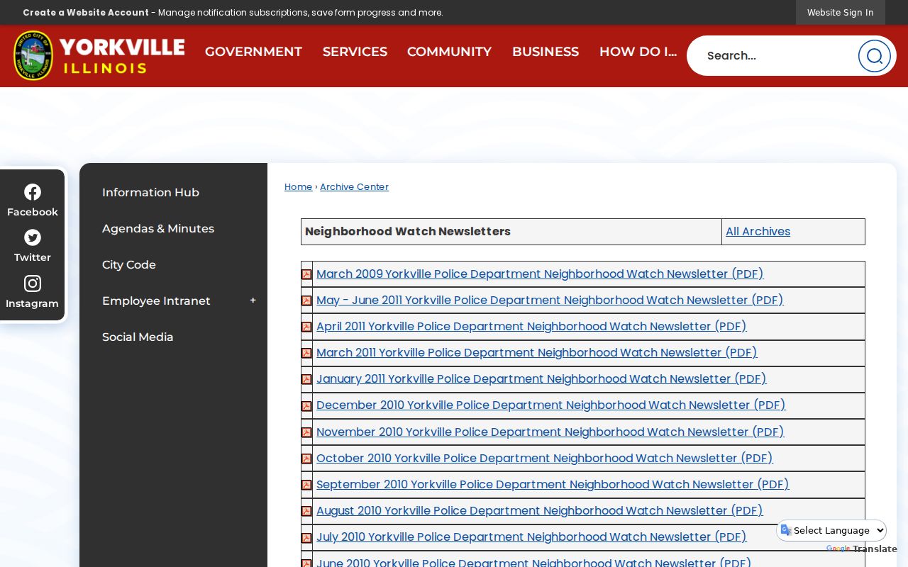
The archive can date a public safety message or describe phone trees, cleanup projects, and police coordination. No public member or block-captain roster was found, so do not infer membership from the area covered by a newsletter.
Compare Yorkville Neighbor Maps
Current neighbors occupy a landscape shaped by old plats, roads, and municipal changes. County layers include an 1830 survey, 1871, 1875, 1908, 1922, and 1941 plats, a 1939 aerial, 1940 zoning, and later aerials through 2024. The time slider warns that dates before 2019 are not maintained in a uniform way and that undated features may not filter. Use it to form a question, then verify the document.
The 1892 Yorkville Sanborn map gives a building-level historic view: footprints, uses, street and block numbers, doors, windows, water facilities, factories, and shops. It can show whether a structure or commercial use existed on the block at that date. It cannot supply the present household or establish every person who occupied the building.
Geography also affects apparent proximity. A parcel may carry a Yorkville mailing label while county fields show a township or a different municipal status. Bristol and Yorkville consolidated in 1957, and later expansion extended mapped areas. Verify the exact parcel rather than assuming that the ZIP, township, subdivision, and city boundary all match.
Yorkville Neighbor Records Compared
Official records are narrower than commercial neighbor-search pages, but their limits are visible. County GIS identifies its source layer and caveats. A Recorder instrument can be ordered and cited. A city newsletter has a publication date. Commercial profiles may blend old feeds, similar names, and inferred relatives without making the source or update date clear.
| Method | Strength | Limit |
|---|---|---|
| Official parcel, plat and city map | Named custodian, defined fields, dated layers | Ownership and geography do not prove occupancy |
| Official civic archive | Public event, group, role or newsletter context | Not a private membership list |
| Commercial compiled profile | May gather broad leads | Source dates and identity matches can be unclear |
For a reliable result, cite the official layer, retrieval date, and precise claim. Avoid copying bulk results. If an address is protected or a field is withheld, do not try to reverse the protection through another dataset.
Verify Yorkville Neighbor Boundaries
Visual adjacency is not always legal adjacency. A narrow right-of-way, condominium common area, retired parcel, or subdivision line can separate lots that appear to touch on a screen. The county's parcel documentation also warns that common areas may be duplicated and that its compiled GIS is not a survey. Use the map to identify the PINs and likely instrument, then check the recorded plat or deed.
The Kendall County Recorder provides counter research and Laredo access for plats and other instruments. Bring the subdivision, lot, PIN, legal description, document number, and an approximate date. Plat research at the South Main Street office stops at 3:00 p.m., one hour before the general research-area close. When a boundary affects legal rights, an official record or professional survey carries more weight than the parcel viewer.
This check also keeps the neighbor search narrow. A notification-radius export may include every selected parcel, but selection does not prove that every listed owner shares the same street, entrance, association, or municipal service area.
Protect Yorkville Neighbors' Privacy
Household members, utility customers, delivery records, private club lists, and protected voter addresses are not public block fields. Illinois maintains an Address Confidentiality Program for eligible survivors. A substitute address must never be reverse-engineered. Voter data also has statutory limits and redactions; Kendall County's voter-file request route is for eligible political committees and government entities, not personal address harvesting.
Recorded land documents can expose defined identifiers by mistake. The Kendall County Recorder accepts its redaction form by mail, fax, or in person for specified account, identification, and similar numbers. Redaction removes a protected field, not the public instrument. A neighbor lookup should collect only what is needed for a lawful purpose, preserve the source date, and omit personal contact details.
Lawful use. Use Yorkville neighbor records for civic context, reconnecting, or personal safety awareness. Never use them to watch, harass, intimidate, or harm anyone.