
Walk a Yorkville Street Record Trail
An address-first search should move from the map to the legal index, then to sources that may suggest occupancy. Kendall County GIS can identify the parcel and its geography. The Recorder confirms legal instruments. Voter information is governed by Illinois Election Code and should be used only through the county's official routes. Dated directories and newspapers can add an older household or business association.
No single step settles who lives at a Yorkville address now. Save each record's date and stated relationship. A tax mailing field may lead away from the site, while a deed party may have transferred the land years ago.
- Enter the full site address in the county property-information quick lookup and confirm the PIN.
- Open adjacent parcel and cadastral layers to understand the whole Yorkville street segment.
- Carry the owner lead, PIN, legal description, or document note to the Kendall County Recorder.
- Use official voter services only within the county form and Illinois use limits.
- For an earlier period, compare the block with a Sanborn map, atlas, newspaper, or dated directory.
Yorkville Street Search Fields
The Kendall property-information quick lookup guide explains the practical starting fields. Search by address or the hyphenated PIN. Address autocomplete reduces spelling errors, while condo sites may return several parcel choices. Once the parcel panel opens, keep both the display value and the layer date.
The street directory depends on fields that must not be blended. Municipality and township are legal or administrative geography. The site city and ZIP describe the parcel location, while owner city, state, and ZIP belong to the mailing record. A short legal description and parcel type help confirm that the selected map feature is the intended lot.
| Portal field | Input or result | How it helps by address |
|---|---|---|
| Site address | Autocomplete input | Finds the mapped location |
| PIN | Hyphenated input or result | Connects maps and county files |
| Municipality and township | Parcel result | Separates civic jurisdictions |
| Owner mailing fields | Parcel attribute | Shows where tax correspondence goes |
| Document note and date | Historic attribute | Provides a Recorder lead when populated |
Yorkville County GIS Opens the Map
The public Kendall County GIS Portal is the main map doorway for a Yorkville street directory search. It links parcel, cadastral, address, subdivision, cemetery, voting, polling, and historic resources. County data can be viewed in a web tool or obtained through the open-data catalog, though some downloads require the user's own GIS software.
The portal landing page shows where map and data products begin. Its layout helps separate a public web map from a raw layer or county guide.
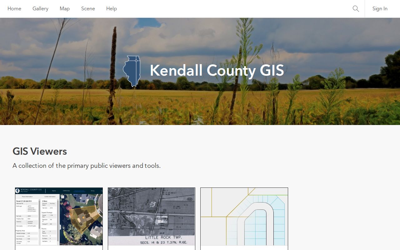
The screenshot supports the first step in the address trail: choose the right county map product before reading a parcel. County terms also prohibit repackaging, resale, or redistribution of GIS data, and the map is not a legal survey.
Yorkville Parcel Fields Need Dates
The county's parcel-layer documentation lists the schema and its historic limits. Current and historic features can carry PIN, parcel type, municipality, township, site address, mailing attributes, assessment and tax classes, a brief legal description, document notes, and created or retired dates. Those fields describe a mapped record, not the full deed chain.
The official parcel catalog displays both the useful columns and the warning that historic document coverage is limited. That warning is central to any search by street.
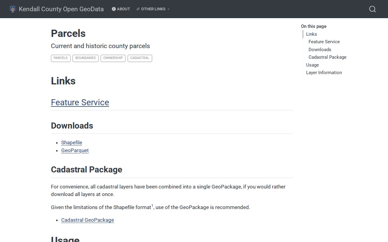
A 2018 sample may include a NEW PARCEL note and document number, while an older sample may lack a created-document value. The difference does not prove that an older deed is missing. It means the Recorder index, plat books, library, or IRAD may be needed.
Yorkville Aerials Are Snapshots
Kendall County GIS provides historic imagery and a time-slider guide. Available material reaches from an 1830 survey context through 2024 aerial imagery, but the time slider has gaps and pre-2019 behavior is limited. Aerials can show when a road, subdivision, lot pattern, or visible structure appears. They cannot name a resident or replace a recorded plat.
When two map years differ, record both dates. A newer roofline or lot line is only a visual prompt until a deed, subdivision document, permit, or official parcel change confirms it. Features with no date should not be forced into the timeline. The street-by-street method works best when the researcher writes “visible by this image year” rather than claiming a precise construction or ownership date.
Note: Current imagery can be newer than a linked parcel-history field, so cite the layer and the date instead of calling the whole map current.
Yorkville City Maps Add Civic Layers
The city's GIS and Mapping page adds Yorkville-specific property, construction-project, ward, zoning, street, development, and trash-day tools. It also preserves city map sets from 2019 through 2024 and publishes a current 2026 set. These resources help show whether an address sits within a ward, zoning district, municipal limit, or active project area.
The city map page is visually distinct from the county parcel catalog and should be cited for civic geography rather than legal ownership.
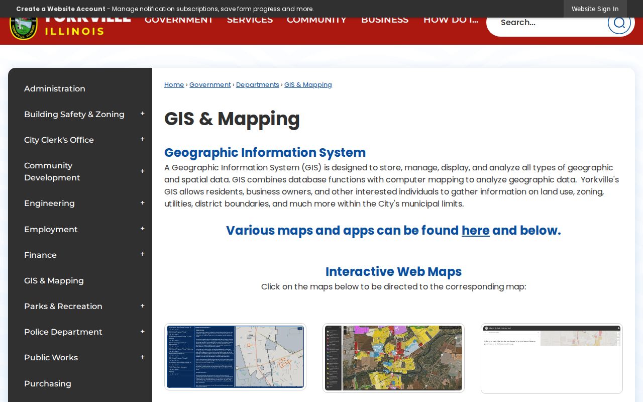
The displayed links help a street search move from a parcel to Yorkville's administrative setting. The city pages reviewed do not advertise an owner-name index. Pair a city map result with the county PIN and Recorder file rather than treating a city label as ownership evidence.
Yorkville Records Organized by Street
Address-keyed records answer distinct parts of a Yorkville street question. GIS shows spatial relationships. The assessment office maintains record cards and the roll. The Recorder holds legal instruments. City Hall routes permit, zoning, and municipal-map requests. Older maps, atlases, and newspapers add a dated physical or social layer.
| Address source | Yorkville custodian | Street fact it can show | Access channel |
|---|---|---|---|
| Parcel and cadastral maps | Kendall County GIS | PIN, parcel shape, site geography, document leads | Portal, open data, county guides |
| Assessment record card | Supervisor of Assessments | Assessment and property-record fields | Office, phone, publications, FOIA |
| Deed, mortgage, lien, or plat | Kendall County Recorder | Named legal parties and land description | Laredo or research counter |
| Permit or zoning file | Yorkville city offices | Dated work or land-use process | Forms, office route, or City FOIA |
| Sanborn, atlas, or newspaper | Library and archives | Dated building, business, or household clue | Digital item, microfilm, or reference request |
Property-specific assessment questions go to the Supervisor of Assessments at 504 S. Main Street or 630-553-4146. The inspected official page did not expose a stable public owner-name search, so the office and written-request channels must remain part of the street directory workflow.
Yorkville Deeds Supply the Legal Chain
The Kendall County Recorder keeps deeds, mortgages, liens, releases, and plats. Laredo provides remote party-name and tract indexes under a paid agreement revised in June 2025. The agreement describes plans from $100 for up to 250 monthly minutes through $320 for 1,001 to 2,000 minutes, plus overage and print charges. Terms may change, so confirm them on the live county source.
The Recorder does not perform document research or give legal advice. Bring a name, PIN, date range, or document number. The public research area at 502 S. Main Street is open weekdays from 8:00 a.m. to 4:00 p.m., with plats stopping at 3:00 p.m. and documents at 4:00 p.m. Mail and redaction procedures add other channels. A party-name hit identifies a role in an instrument, not a present Yorkville resident.
- Grantor
- The party who transfers an interest in a recorded instrument.
- Grantee
- The party who receives the stated interest.
- Plat
- A recorded drawing that defines lots, subdivisions, or other land divisions.
- Situs address
- The physical site address, which can differ from an owner's mailing address.
Yorkville Permits Follow the Address
Yorkville's Building Permit Applications page lists residential, commercial, fence, pool, and sign forms and explains approval, payment, and inspection contacts. It is a route to applications and permits rather than a searchable name directory. Exact form fields were not fully captured, so do not assume that every file lists an owner, builder, or applicant in the same way.
A focused request should state the address, PIN when known, permit type, approximate year, and the item sought, such as an application, permit, inspection, or final approval. The City Clerk accepts municipal FOIA requests by mail, in person, or email. Ordinary responses are due within five business days under the city's published procedure, subject to lawful extensions and exemptions. The first 50 ordinary pages are free, with a 15-cent charge for later pages.
Yorkville's 1892 Blocks Need Care
The 1892 Sanborn fire-insurance map offers building-level detail for historic Yorkville. Its two sheets can show street names, blocks, house numbers, footprints, doors, windows, factories, water facilities, and commercial uses. It does not list all occupants. Use it first to confirm that a building or use stood on the block, then search a deed, newspaper, directory, or atlas for names.
No official citywide street-renumbering table was found. A modern number that does not fit the Sanborn sheet should be tested against the block layout, legal description, Route 47 history, and newspaper directions. Route 47 bridge and realignment work in the 1960s changed downtown circulation and helps explain why an old building story may not match a current approach. KendallKin's old-building research can add an address transition, but a recorded instrument remains the legal check.
Yorkville Street Names Cross Eras
Historic searches need both a date and a place label. Kendall County's seat moved from Yorkville to Oswego in 1845 and returned in 1864. Yorkville incorporated in 1874. Bristol and Yorkville consolidated in 1957. These shifts can affect the town name, courthouse reference, jurisdiction, or archive attached to an older street record.
The 1870 business directory treats Bristol and Yorkville as a shared business point. A 1914 telephone-directory report describes a regional volume spanning Yorkville and nearby towns rather than a Yorkville-only book. Neither source should be read as a current roster. Search the publication title and year, then pair the listing with a map, land record, or newspaper. Readers tracing the full historical shelf can move naturally to the Yorkville city directory collections once the address has been fixed.
Yorkville Street Directory Boundaries
A Yorkville street directory can identify parcels, recorded parties, map layers, public civic records, and dated directory entries. It cannot prove every current occupant. A named owner may live elsewhere. The mailing address may belong to a tax-contact route. A voter tool reflects registration, while a historic directory reflects one publication year. Utility accounts and DMV addresses are not open substitutes for a public resident list.
Illinois also protects confidential and sealed information. The Address Confidentiality Program can shield a survivor's location. Juvenile, adoption, medical, victim, and some court records have separate limits. A portal gap may reflect privacy, old paper records, a spelling mismatch, or a dynamic form, not the absence of a person or record.
Lawful use. Yorkville address records are for lawful personal, property, family, and civic research. Never use them to stalk, harass, intimidate, or harm anyone.
State the relationship each source proves, cite its date, and verify important findings with the custodian. That discipline turns a street-by-street search into a defensible record trail without exposing private contact data.